The discovery of the city location
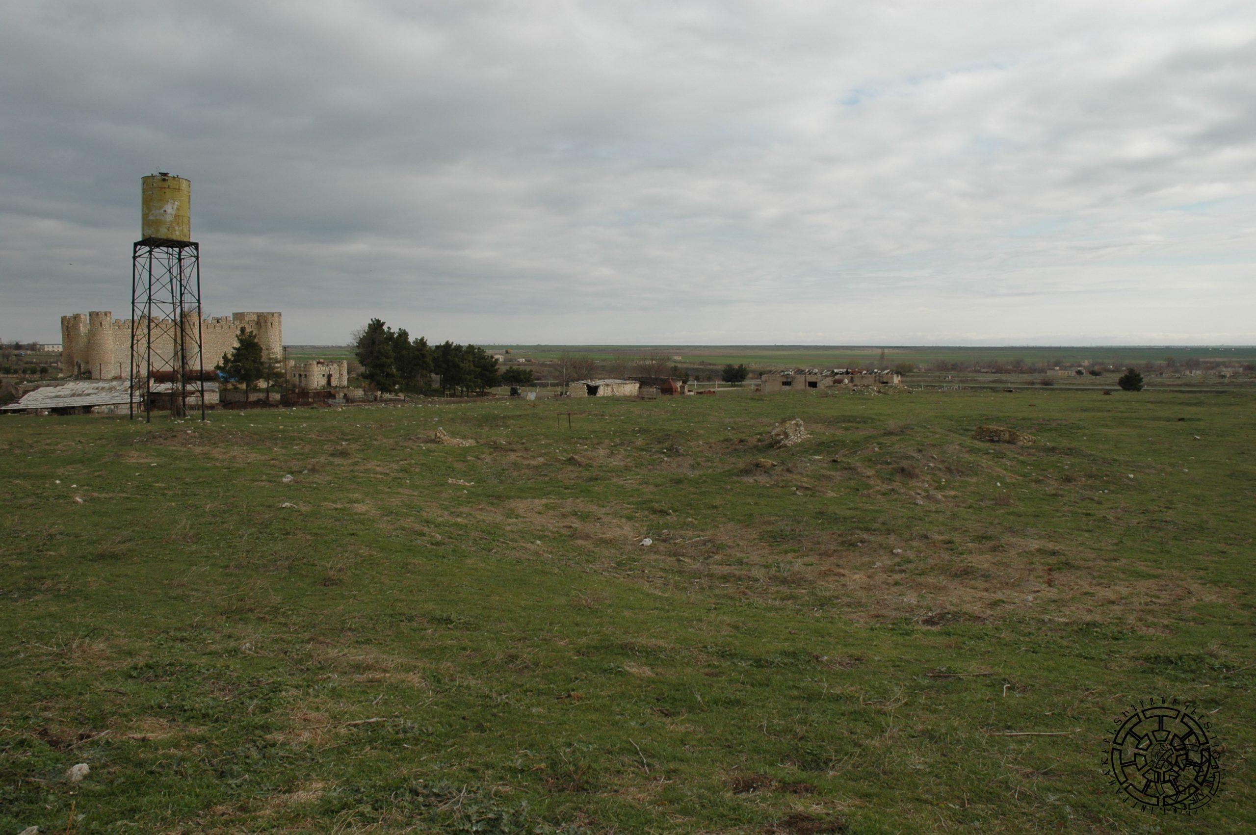
The examination of the existing sources and topographical and historiographical materials about Tigranakert of Artsakh provided a basis to consider it probable that the ruins of the settlement should be sought in the Khachenaget lower valley. This valley is where the Artsakh mountain range, with its accented depressions, merges with the steppe. In ancient times, these areas were approximately divided by a line stretching from northwest to southeast, separating the provinces of Artsakh and Utik in Greater Armenia. According to the 7th-century historian Sebeos, the “other Tigranakert,” which belonged to Utik, and the “avan of Tigranakert,” which belonged to Artsakh, were located on this line. In 2005, in order to clearly locate Tigranakert of Artsakh, the research group accepted the Khachenaget River access point to the plain as a conditional center and studied the monuments of a large area with a radius of about 10 km. Among the monuments attested here, the most remarkable are, of course, the two large settlements located at almost equal distances from the right and left banks of Khachenaget. One is near the village of Sofulu, and the other is near the Royal Springs (Shahbulagh) (Fig. 1).
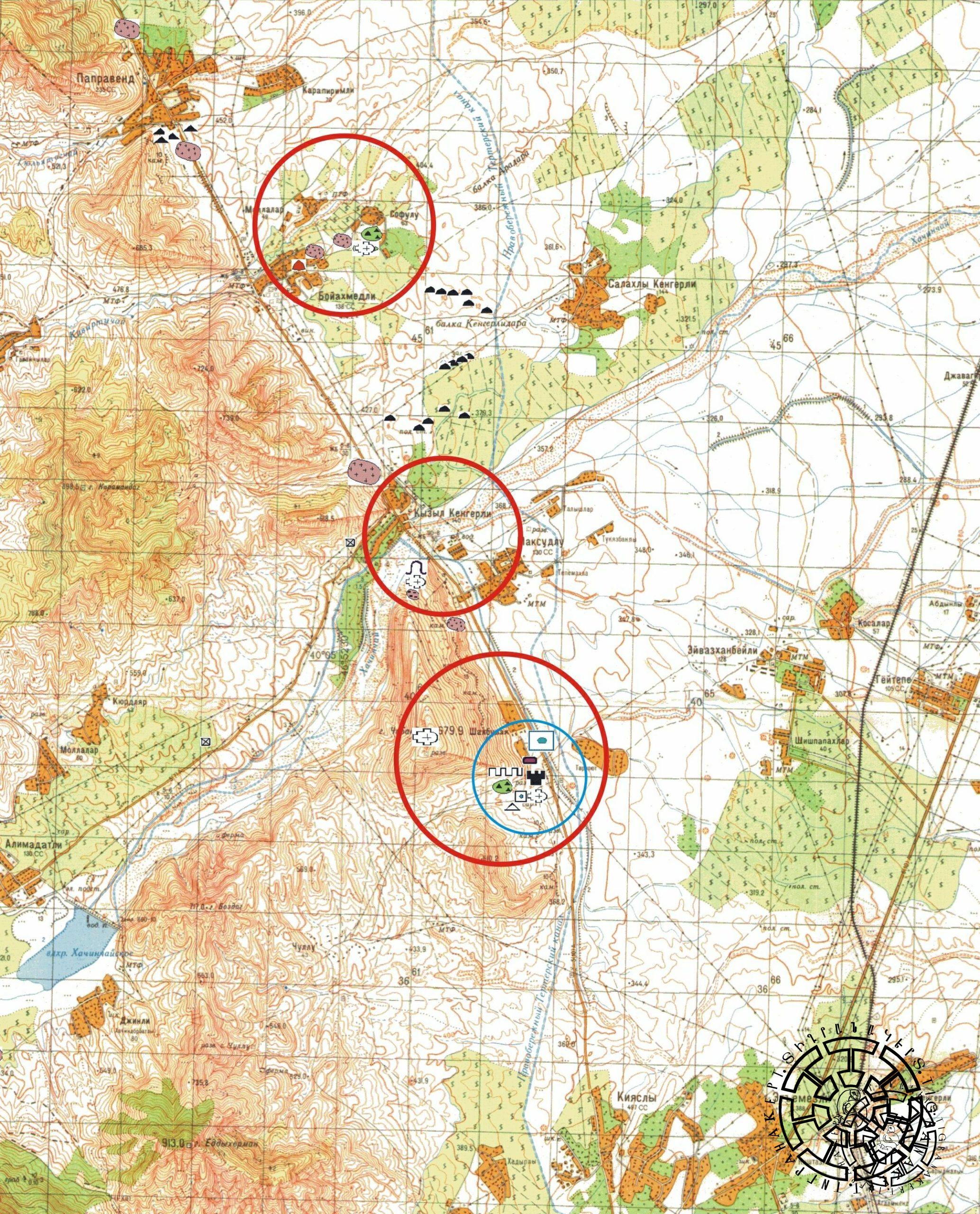
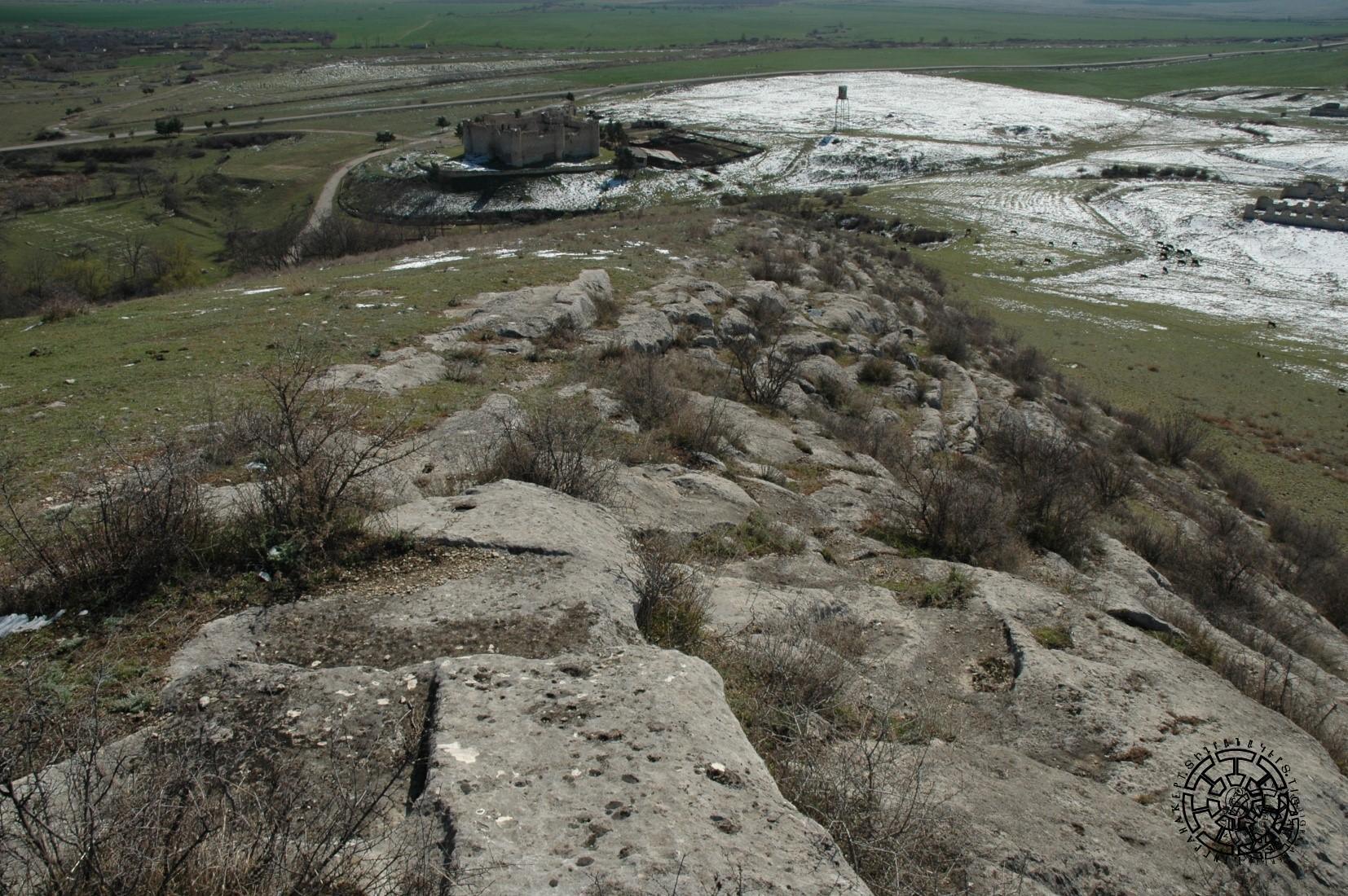
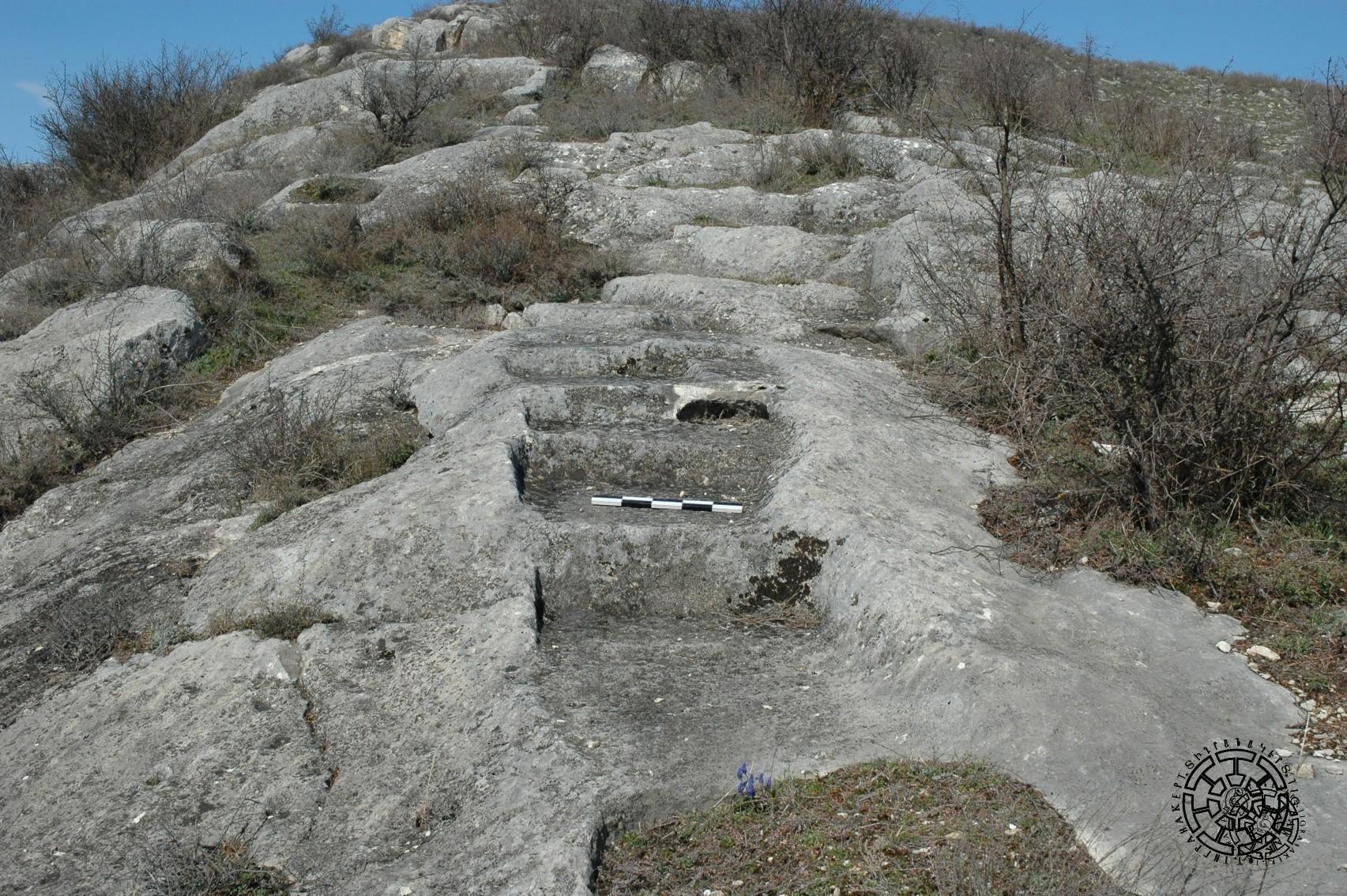
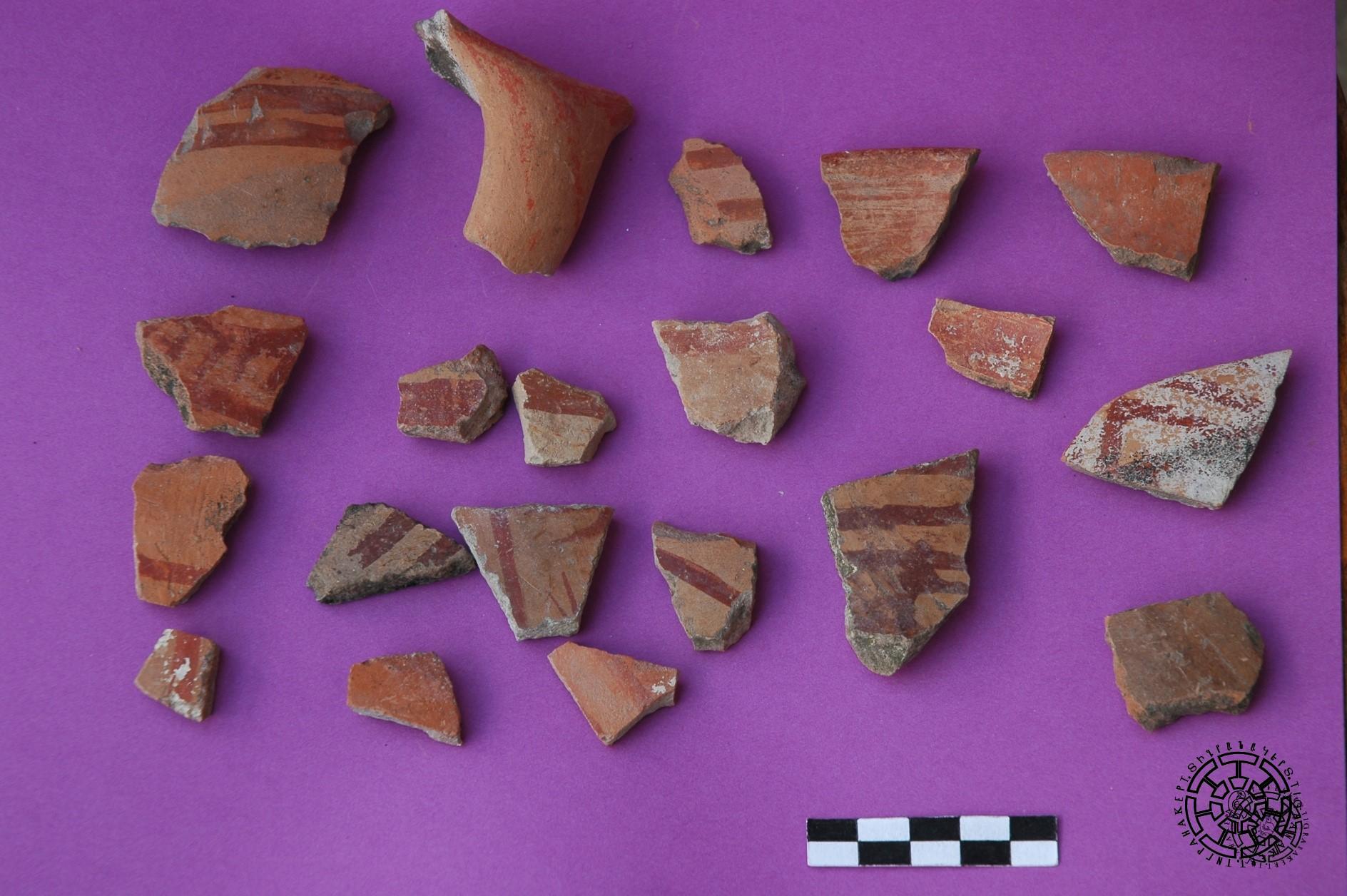
In the armenological literature, these two points were considered as possible locations of Tigranakert. The results of the research led to the conclusion that the ruins of Tigranakert should be found in the vicinity of the Royal Springs, known among the 19th century’s topographers as Tngrnakert, Tarnakert, Taranyurt, or Tarnagyurt, with a sound very close to Tkrakert, used by Movses Kaghankatvatsi, and finally to Tigranakert. The results of this investigation can be considered sensational. Approximately one hundred and thirty meters to the north-west of the Royal Springs, on the rocky ridge of the southeastern lower slope of Vankasar, about 400 meters of traces (Fig. 2) were confirmed. These traces include rock-carved ribbon-shaped bases (Fig. 3) intended for defense wall squares, as well as bases of semicircular, circular, and rectangular towers. Dozens of pieces of colored pottery (Fig. 4) dating back to the first centuries BC and AD were collected directly from the ground near these fortifications.
About two hundred meters south of the same springs, in a large plain, the Central Quarter (Fig. 5) of the city was verified, with traces of thick stone walls of a church building and hundreds of fragments of early and developed medieval pottery. Southwest of the Central Quarter, traces of a large early Christian cemetery were excavated at the trenches dug for the silo during the Soviet era (Fig. 6).
Therefore, the collected city planning and archeological data formed the basis for locating the city on the lower slope of Mount Vankasar and in its adjacent plain, in the immediate vicinity of the Royal Springs.