The Fortified Quarter
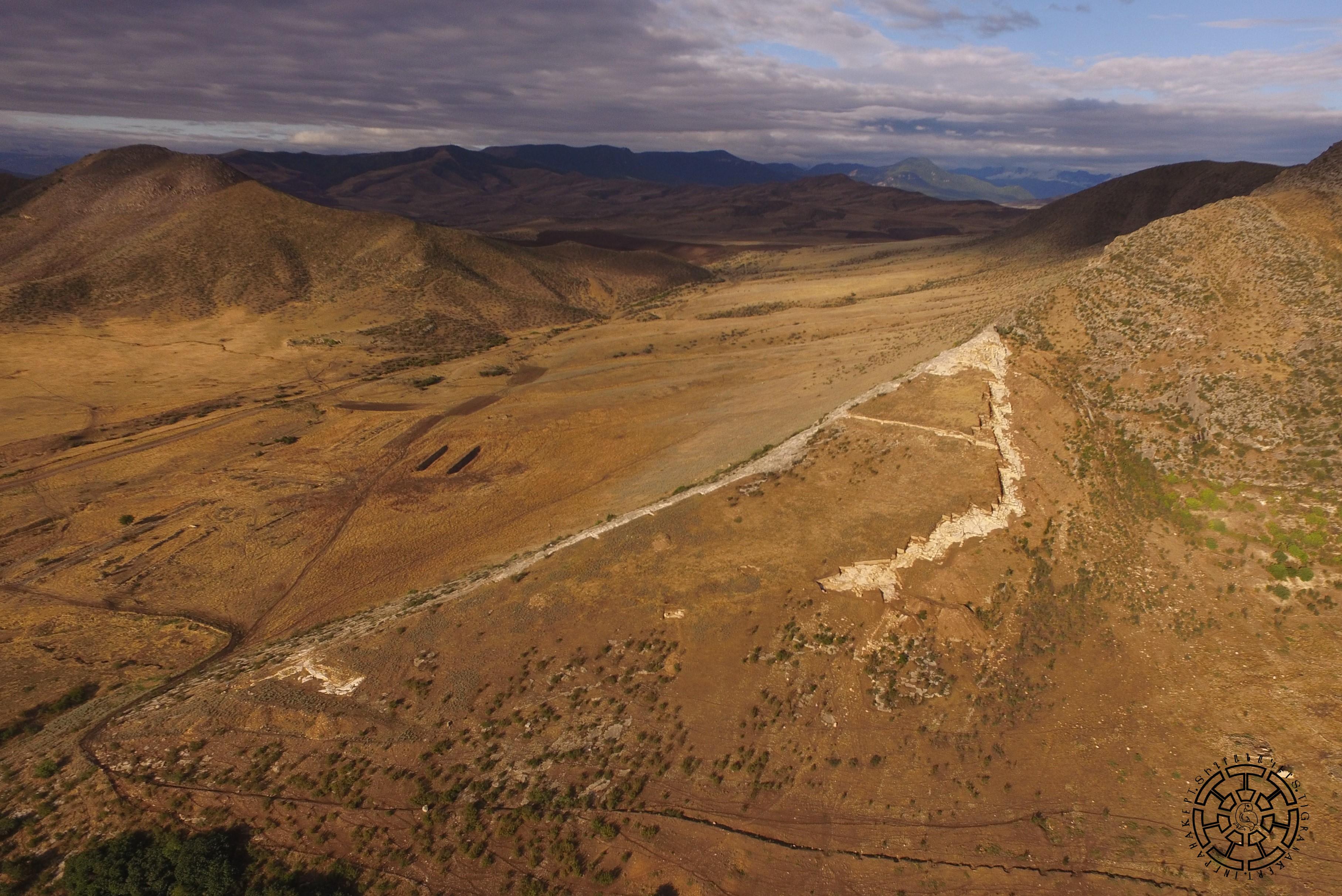
The Fortified Quarter of Tigranakert is located on a naturally formed triangular cape in the lower part of the southwest slopeof Vankasar Mountain, adjacent to, and north of the Royal Springs (Fig. 1). That is, the castle does not occupy the top of Mount Vankasar, which dominates the surrounding area, but the lower part of its southern slope. It covers an area of about 6.0 hectares. The top of the roughly triangular fort is the highest point of the structure, and the base directed to the plain. Although the cape has naturally high cliffs, along whose contours the defensive walls followed), the fort’s location on the slope of the mountain weakened its strategic advantage. The incline of the area is about 60 meters on 500 meters, necessitating additional engineering and defense measures. The builders may have accepted this “inconvenience” in order to be as close as possible to the fresh springs under their protection. Considering that Vankasar borders the Khachenaget River, at the point where it exits the steppe, it is likely that the Tigranakert fortress not only controlled the steppe and the trade route passing through it but also guarded the entrance to the river valley.
From the very beginning of his rule, Tigranes was convinced that a military conflict with the Parthians was inevitable. If this should come to pass, the invasion of the northern tribes at the instigation of the Parthians was also almost inevitable. Taking into account that we have a written reference of at least two Tigranakerts in the Artsakh foothills adjacent to the steppe, it is probable that in order to prevent the possible invasion of the northern tribes, Tigranes placed fortresses in the foothills, which kept the steppe under control and protected the entrances to the river valleys. Taking into account the lower limits of the archaeological complexes of Tigranakert, which does not extend beyond the boundary of the first century BC, it is more than likely that Tigranes started to implement this plan immediately after the invasion to Cappadocia in the late 90s or early 80s of the first century BC. The foundations of all the structures of the Tigranakert fortress excavated so far, including the defensive walls, towers, and antique structures of the citadel, are exclusively rock-carved, a construction technique that was not documented in Artsakh until then but was widely spread in Cappadocia and in the antique cities of Armenia (Yervandashat, Armavir, and Artashat).
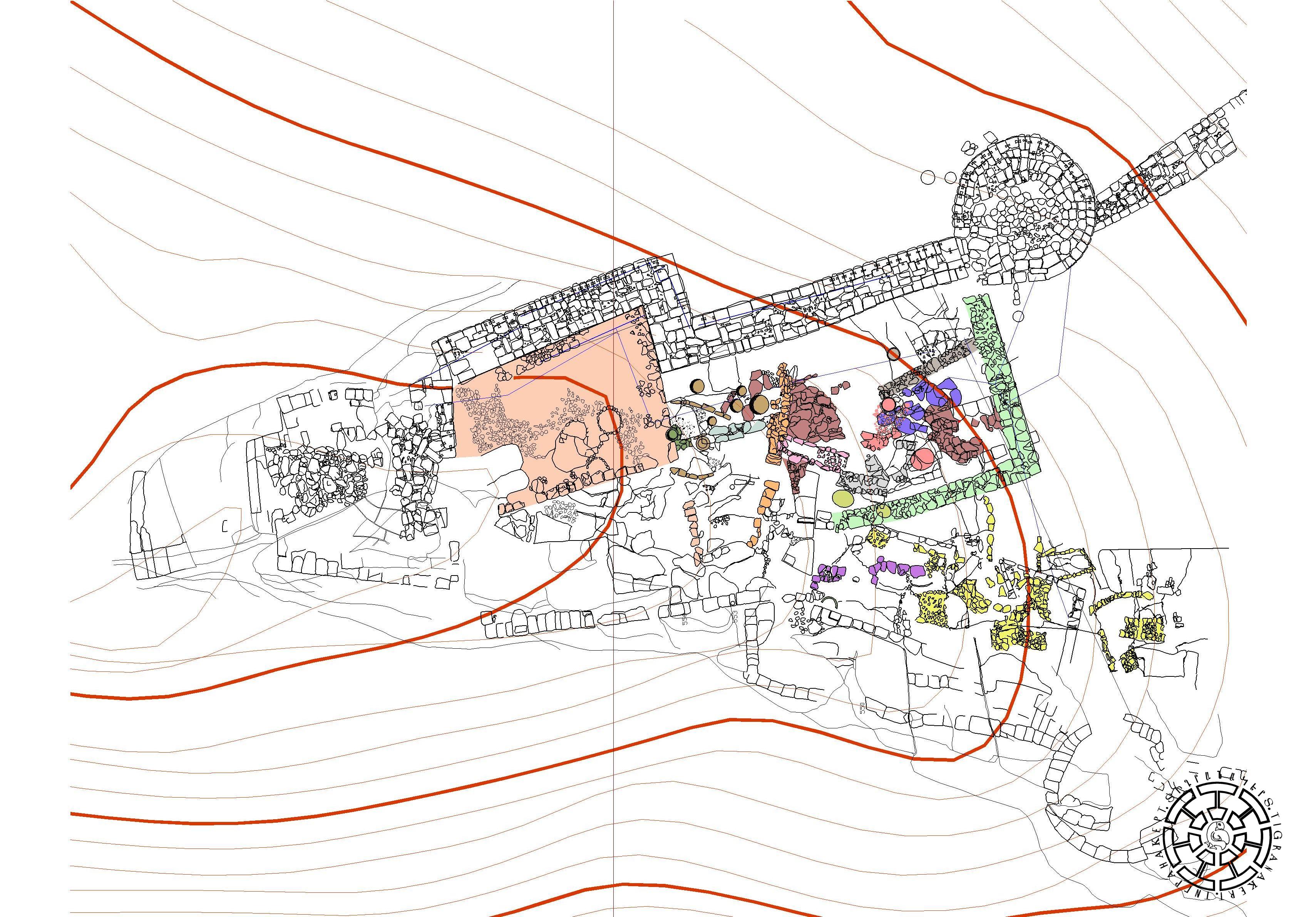
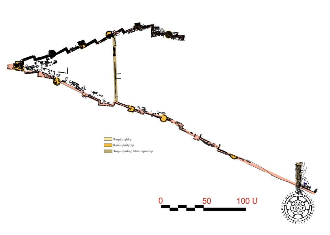
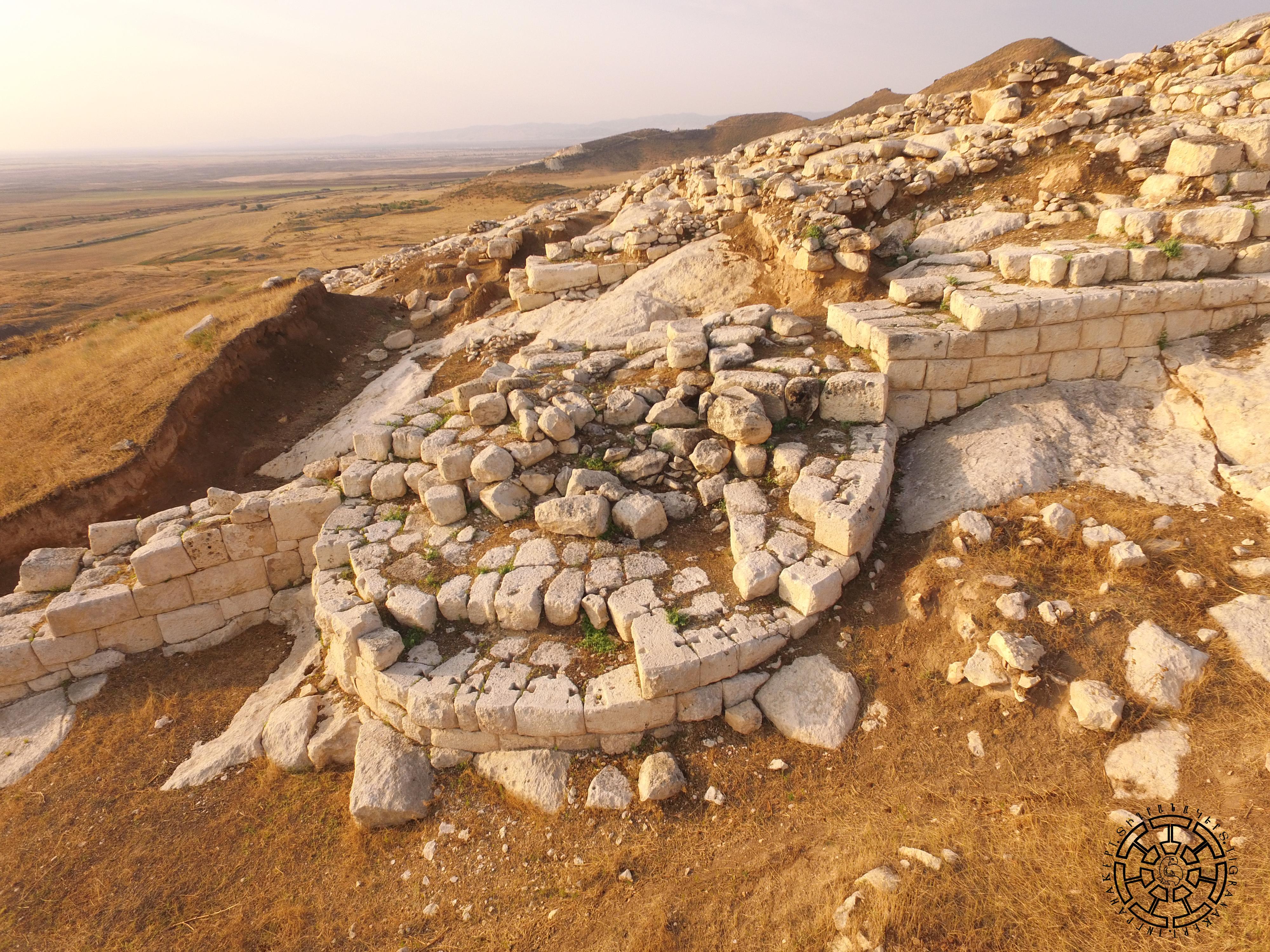
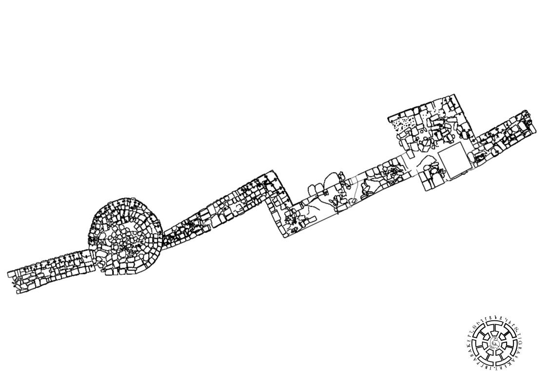
As noted above, the Tigranakert fortress is located on a triangular cape, which has the Royal Springs at its base, and a rectangular tower is placed on top, from where the southern and northern walls begin, forming the sides of the triangle (Fig. 2). The rock-carved foundations of the southern wall are mostly preserved (Figs. 3, 4). In some places, the northern wall has been preserved up to five meters (Fig. 5) and with alternating rectangular and round towers (Figs. 2, 6). The defensive construction required considerable technical skill.
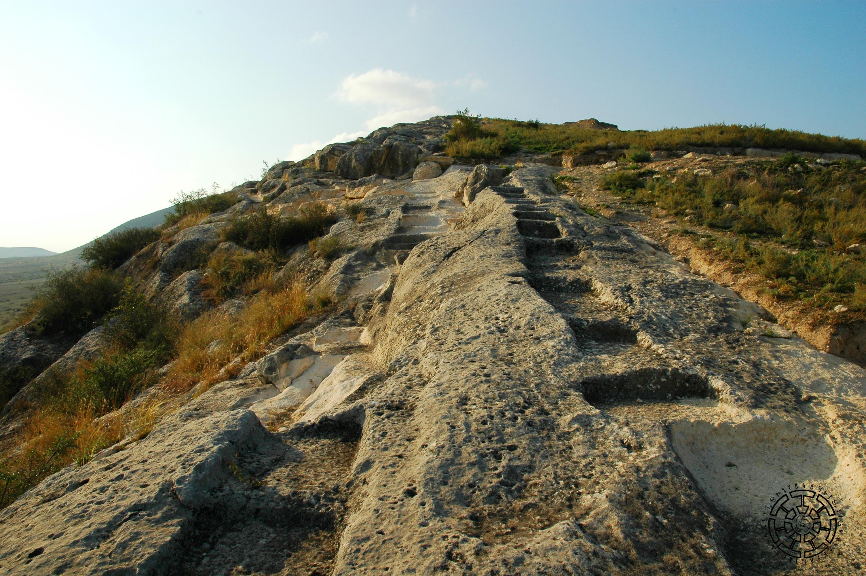
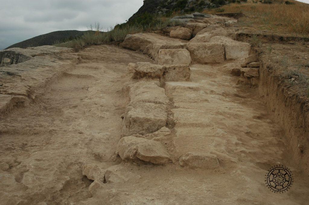
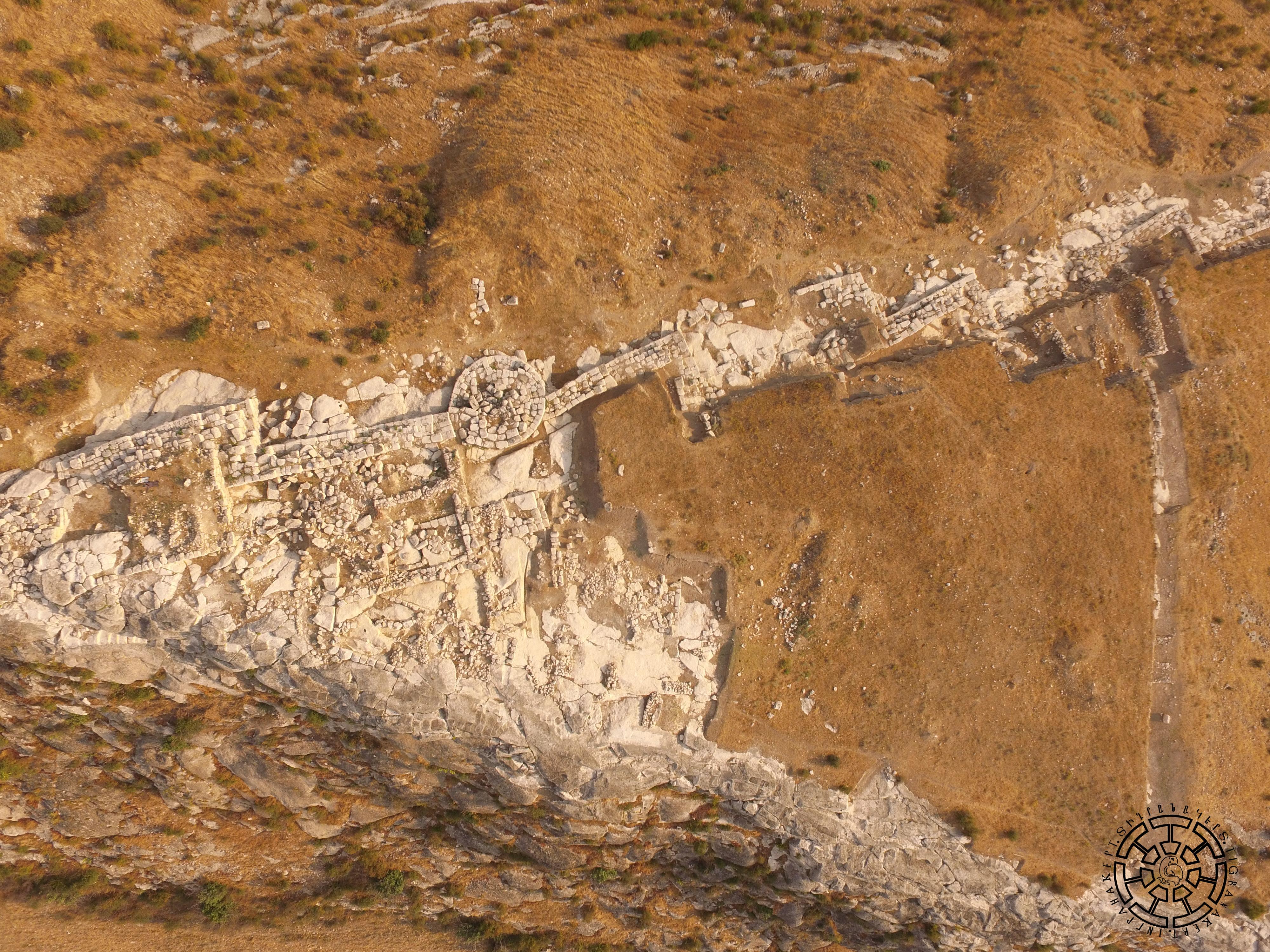
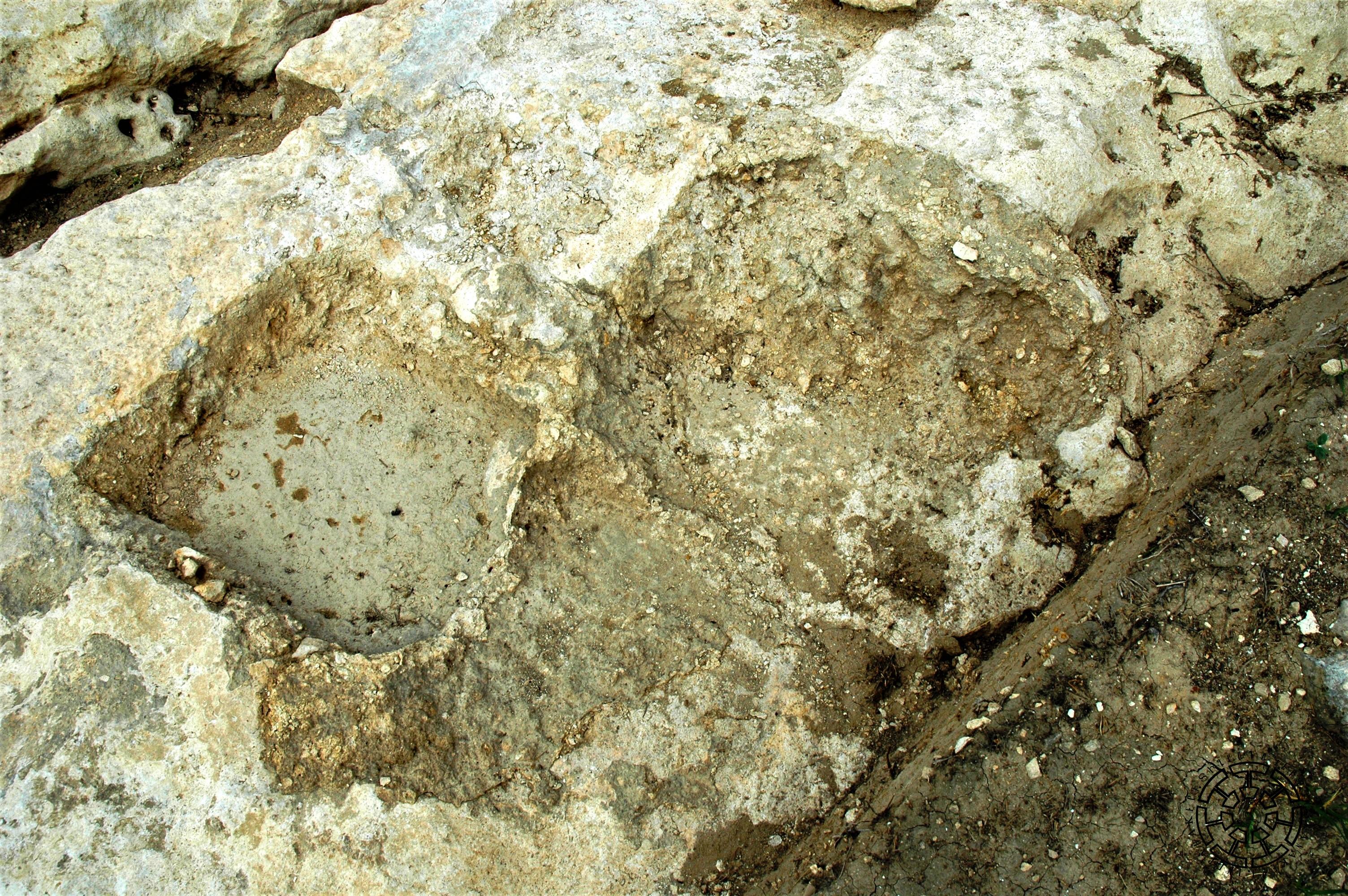
Traces of southern defensive wall that stretches above the slope of Vankasar were visible even before the excavations in the form of rock-cut foundations extending more than 450 meters. With their strip-shaped and step-like structure, Azerbaijani researchers once mistakenly considered these elements to be steps leading to the 7th-century temple on top of Vankasar. The narrow strips carved into the rocks were more likened to a road, and that did not allow discovering the city. Before the excavations, we could not have imagined that the walls would have such a structure. It seemed more natural to assume that a regular brook base equal to the width of the wall (the width of the wall varies between 2.60 and 2.80 meters) should be dug, in which the squares of the first row would be placed. In fact, the separate foundations of the outside and inside rows of the four-row defensive walls (Fig. 3) were carved into the rock in the shape of strips, which were brought to an approximately horizontal appearance by finishing, and into which the bases provided for the separate squares were dug. To the extent that the upper rows of walls have an almost perfect horizontal plane, the wall bases follow the slope of the terrain. This means that the stones in the first (and perhaps also the second and third) rows had a more sloping lower surface and a more linear upper surface. That is, instead of bringing the rock to a horizontal plane, it was achieved by processing separate stones, which was obviously a less labor-intensive process. The bases were filled with a mortar composed of lime and limestone chips, in which the squares were immersed and fixed (Fig. 7). The bottom of the foundation between the outer and inner strips was not always worked; it was filled with mortar and rough stones so that in the third or fourth row of the height of the wall, they had a surface equal to all four rows. In addition to strengthening the blocks of the first row and filling the voids between the blocks, mortar was also used to fill and plaster the gap between the foundation and the rock so that rainwater would not fill under the foundation. Such a variety of uses of mortar in the first century BC are attested for the first time in the region. As a rule, the outer strip is wider than the inner strip, and the two together make up 60-70 percent of the wall width. Thus, exploration of the foundations reveals the use of detailed and carefully thought-out construction techniques, which made it possible to adapt the defensive wall as much as possible to the vertical and horizontal fluctuations of the site, skillfully combining the various groove-ribbons, steps, and platforms. As we can see, the wall does not rest on one solid mass at its base but on three separate “feet” (the outer and inner rows and the mass between them). We think it also had an anti-seismic role by dividing shocks into components close to the base.
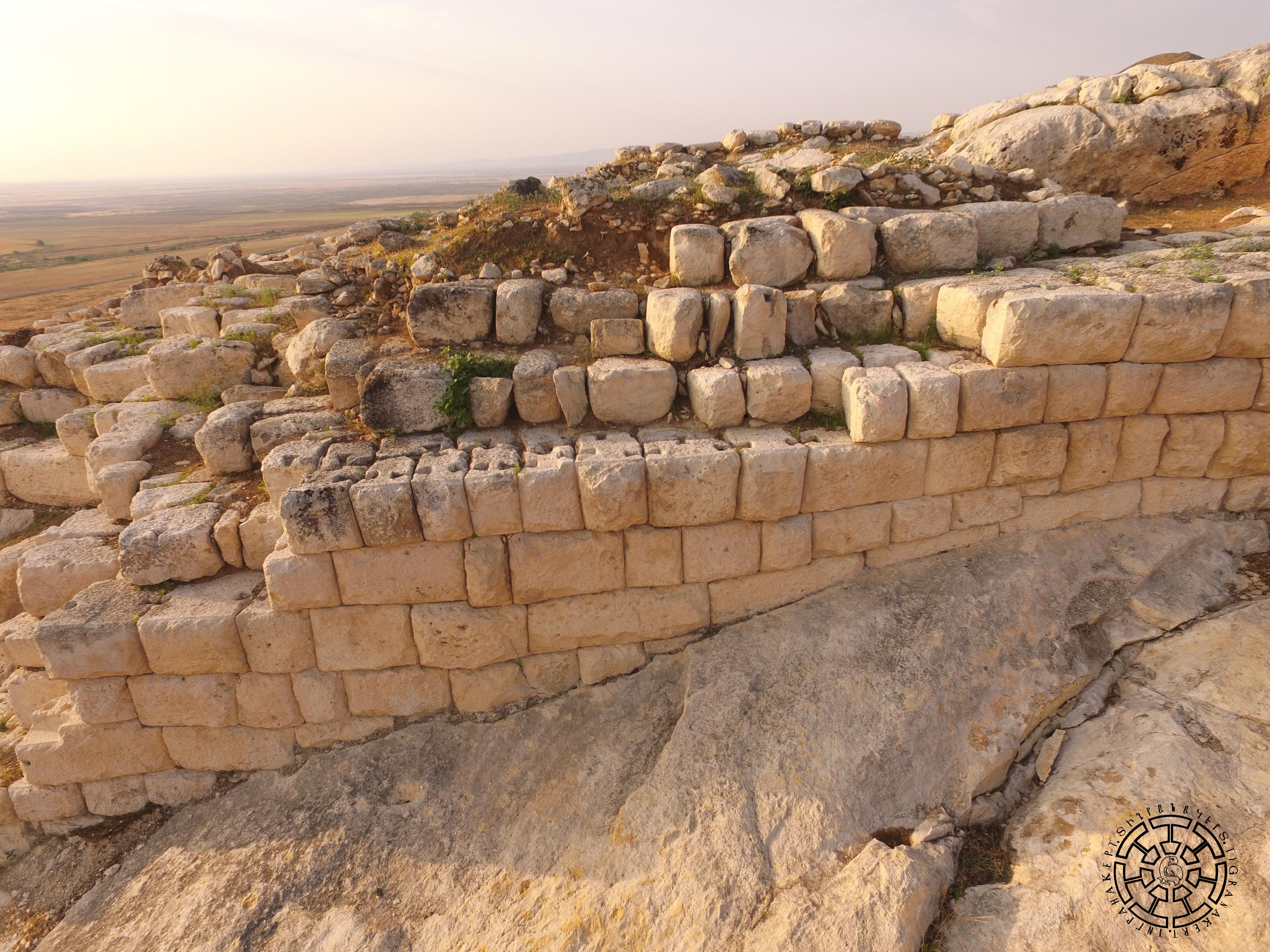
The squares of the outer and inner rows of the wall have perfectly worked surfaces, a rustic (pillow-like) elaboration of the outer faces, and expertly made facets (slanted cuts to the outer edges of the blocks). Large blocks are simply placed on top of each other; small blocks are additionally connected with ‘’swallow-tail’’ connections (Fig. 8). The average dimensions of the blocks are: height: 0.45-0.70 meters; width: 0.30-1.2 meters; length: 0.4-1.5 meters. Wood was used as a binding material, and in rare cases, a lime-concrete and gravel mixture. This technique was widespread in Asia Minor, Mesopotamia, and the Ararat Valley, but previously unknown in Artsakh.
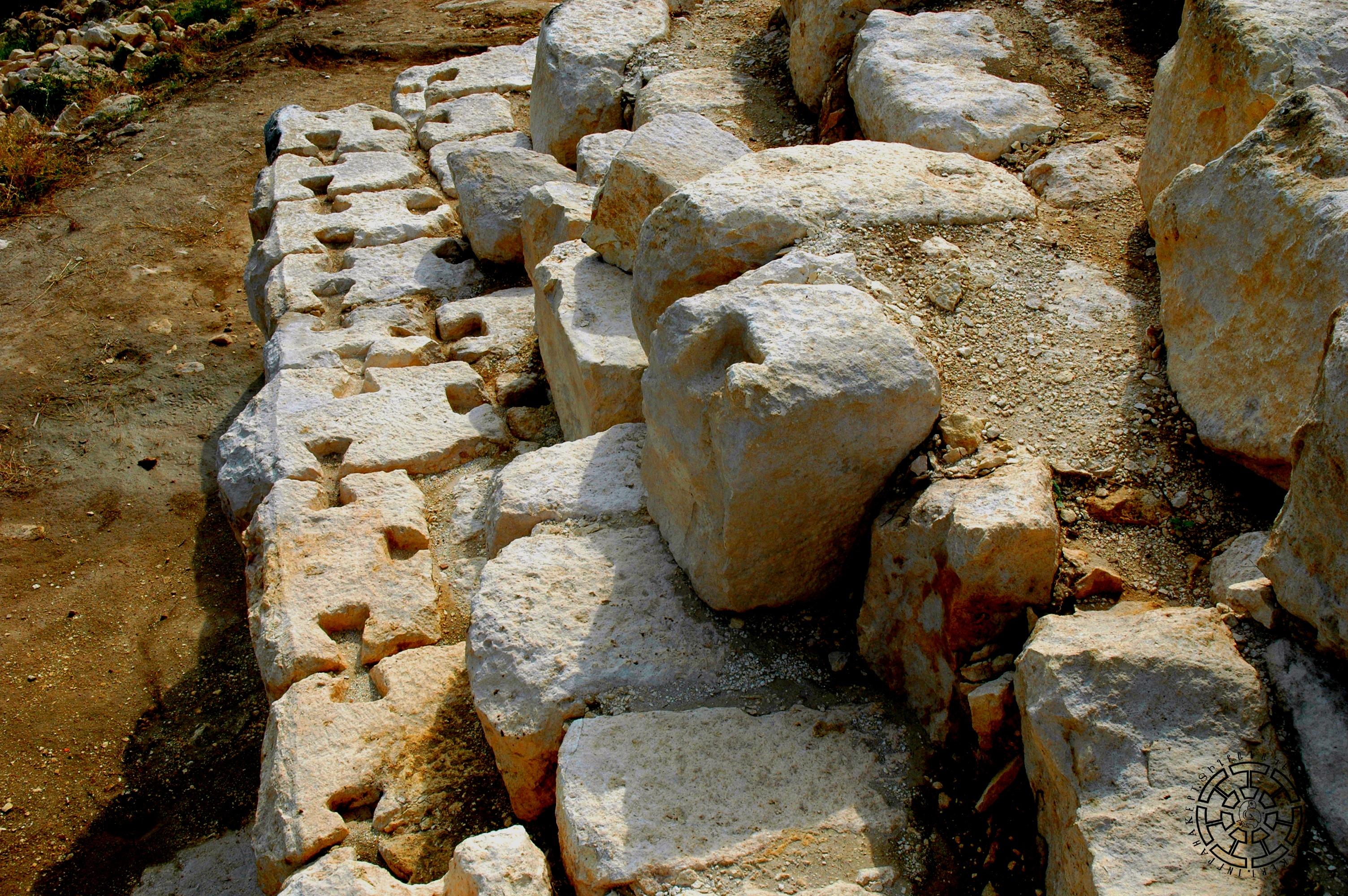
The smaller the blocks, the more frequent the ‘’swallow-tail’’ connections. This gives reason to believe that walls with small blocks were weaker and subject to additional strengthening. It can also be stated that more often the stones of the outer rows were fixed with such connections, perhaps with the same concern. Such a construction technique had a certain prevalence in several ancient sites of the Hellenistic and late antique periods of Armenia (Armavir, Artashat, and Garni) and Georgia (Bagineti).
The whole fortification system of Tigranakert consists of three components: a rectangular tower, a round tower, and a zigzag wall connecting them together (Figs. 2, 9). The zigzag wall, in turn, consists of two arms and a zigzag section. Sections are only rectilinear; bends are rectangular or acute. Depending on the relief, the zigzag wall has different lengths (the shortest is 7.0 meters, the longest is 25.5 meters, and the zigzag section is 1.5 meters to 9.8 meters) and different directions. Basically, in the case of the Tigranakert fortress, we are dealing with a model adapted to the terrain (Fig. 2), the mandatory components of which are consecutive rectangles (length of sides: 7.0-8.0 meters) and round towers (diameter: 9.0 within meters) and the wall connecting them with at least one zigzag. The different lengths and directions of the walls are essentially the technical means by which the triangular model was adapted to the natural defense possibilities of the site.
The Tigranakert defense system exhibits close parallels with Near Eastern classical (Miletus, Ephesus, Pergamon, Priene, Magnesia on the Meander, Dura-Europos, etc.) and some Transcaucasian monuments. In particular, the general characteristics of construction techniques, including rock-carved foundation, use of stone blocks for the foundation, dry laying, ensuring the strength of the wall by the weight of the blocks, use of swallow-tail connections, use of lime mortar, implementation of the upper part with raw brick, and the dimensions of individual components, including wall thickness, dimensions of quadrangular towers.
In terms of layout and architectural solutions, Tigranakert bears striking resemblances to several ancient cities. It shares similarities with Priene, featuring a triangular citadel that dominates the terrain, along with regularly-planned districts sprawling at the foot and zigzag walls. Parallels can be drawn with Dura-Europos due to the presence of a defensive wall from the 3rd to 2nd centuries BC, characterized by its zigzag design. Tigranakert exhibits significant parallels with Artashat, including a triangular citadel atop the landscape, orderly-arranged districts at the foot, zigzag walls, and a combination of rectangular and round towers. Moreover, the construction details of Tigranakert are almost identical to those of the contemporaneous Armaztsikhe-Bagineti, particularly concerning the defensive wall.
In terms of layout and some architectural solutions, it is very close to Priene (triangular citadel dominating the terrain, regular-planned districts spread out at the foot, zigzag walls), Dura-Europos. (3rd-2nd centuries BC) boundary line (zigzag walls), but especially Artashat (triangular citadel dominating the terrain, regularly laid-out districts at the foot, zigzag walls, a combination of rectangular and round towers), and in some details of construction, it is almost identical to the Armaztsikhe-Bagineti defensive walls. Examining these parallels makes it possible to confirm that Tigranakert was built with the full utilization of advanced architectural thought and construction techniques of the time. These circumstances make Tigranakert a benchmark monument of the first centuries BC to the first century AD because it is much better preserved compared to the corresponding complexes of listed monuments.
Only some details of the inner construction of the Fortified Quarter are clear. The slope of the site dictated that it be built in a terrace manner. Moreover, as a rule, the walls of the terrace were placed on rock-carved foundations and had only an outer surface made of rustic or rough-polished squares. The terrace platforms themselves are a network of boulders lined with a thick, trodden layer of clay. So far, four terraces have been clearly attested, one of which is the wall separating the citadel from the Fortified Quarter, which stretches 63 meters long, is reinforced with masonry, and has an entrance at the junction with the northern wall.
The rock-carved foundations of the walls in the Fortified Quarter of the city, their enormous dimensions, the regularity of construction, the perfect symmetry and fine workmanship of the blocks, and the joining of the blocks with the most advanced Hellenistic techniques (“swallow-tail” connections) undoubtedly testify that they were built with a unified plan, by skilled and advanced architects and by masters. Such an accumulation of strength, thought, and material and the implementation of a grandiose plan in a specific place were possible only in the case of general, state mobilization, a circumstance that further strengthens the belief that we are dealing with a royal and state initiative.
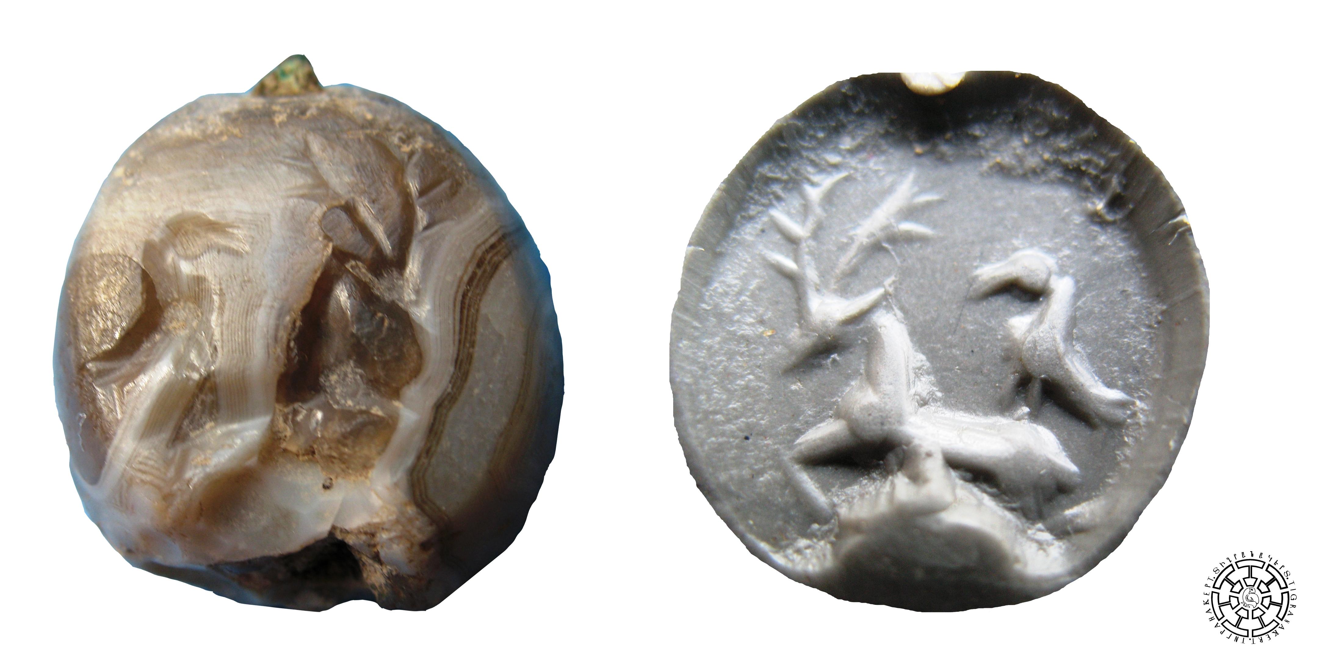
The excavations revealed that in the early Middle Ages, there was an effort to maintain the military capability of the citadel, but from the 11th-12th centuries, it lost its military significance. The top part of the citadel became a densely populated district in the 12th and 13th centuries (Figs. 10, 11). At the same time, the foundations of antique monumental buildings are discernable; not only the walls, but also all the antique buildings were carved out of rock. The pure antique layer is confirmed so far only in the form of “islands”, giving perfect examples of colored pottery from the first centuries BC and AD. The inventions of the ancient seal-gemma (Fig. 12) and Sasanian seals can be particularly emphasized. They indicate that Tigranakert played an important commercial and administrative role.