The fortress of Nor Maragha
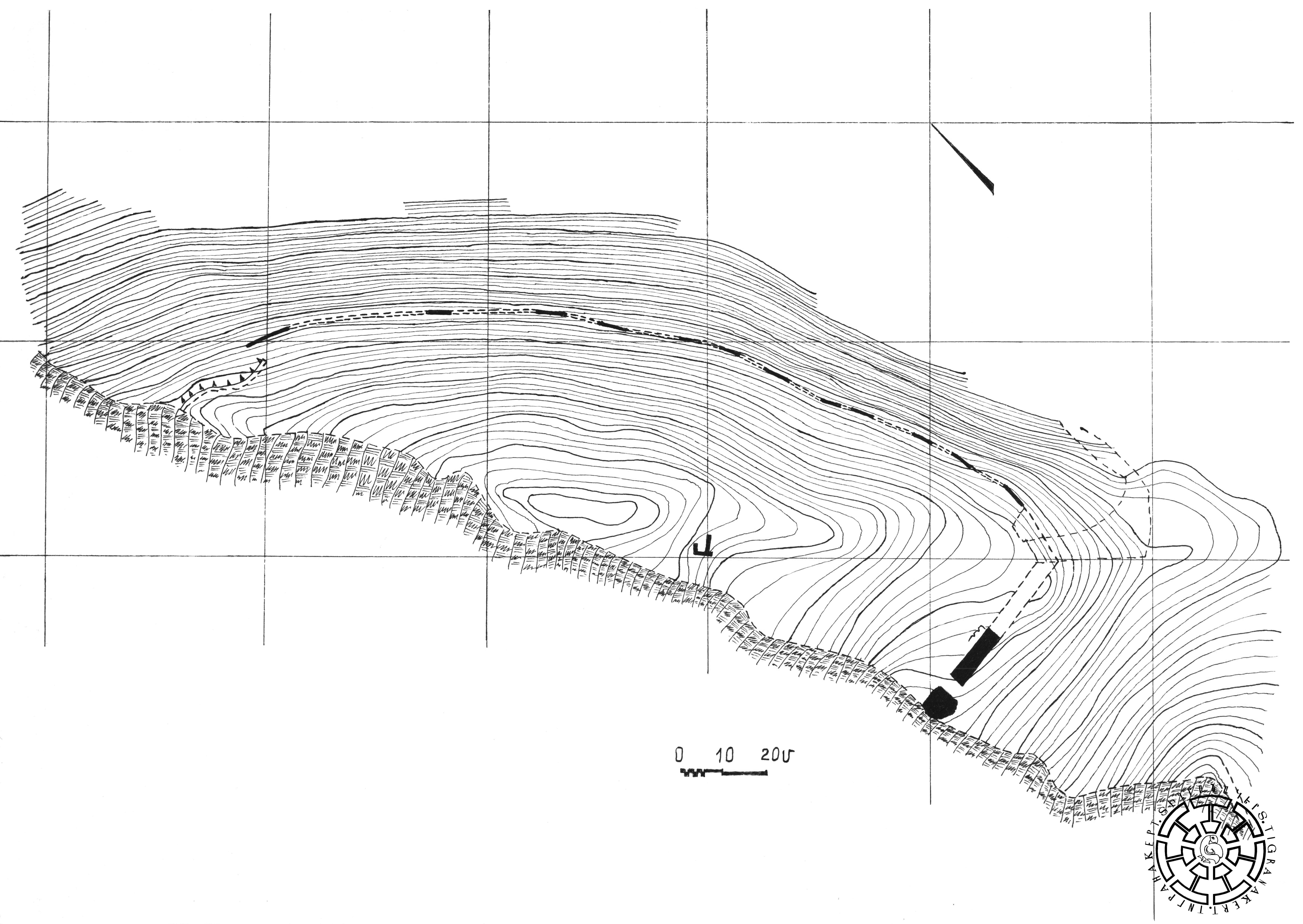
The fortress is located next to Nor Maragha village, on the left bank of the Khachenaget River (Fig. 1). Exploratory excavations were carried out in 2007. The topographical survey, excavation results, and measurements made it possible to draw up the main plan of the fortress (Fig. 2). It spreads over the plateau of the mountain, 630.0 meters above sea level, occupying an area of about 1.0 ha. The entire area of the fortress has a defensive wall. The remains of those walls can be seen along the entire perimeter, repeating the outline of the natural relief. Accordingly, an oval-shaped floor plan stretched along the north-south longitudinal axis was obtained. The central and southern parts of the fortress are elevated. In the central part, the remains of one of the inner rooms of the fortress with plan dimensions of 2.0×4.0 meters and 0.6-meter-thick walls are visible, which indicates an internal construction. The northern side is lower; the height difference reaches 10.0 meters.
Excavations uncovered half of the 40.0-meter south defensive wall and the fortress entrance in the southwestern part of the fortress (Fig. 3). The remains of a semi-circular tower were discovered next to the entrance and the rock cliff. The entrance to the fortress has an asymmetric frontal location and a unique structure: the axis is vertical to the defensive wall and widens inward (3.4 externally, 3.8 internally). It is also distinguished by its rather wide opening, which is not very logical from a defensive point of view. The entrance and especially the tower are lined with large blocks (up to 1.0×0.5×0.45 meters) with a three-layer double-fronted principle. The wall is made of regularly arranged large stones with rough fronts and is 3.5 meters wide. The maintained height is up to 1.0 m. The stones are lined up on both sides of the wall in regular rows. In the structure of the wall, the core made of pebble stone and soil served as a link between the masonry stones (Fig. 4). Here, the volume of the core significantly exceeds the volume of the front stones. The tower is also solid: large blocks lined up in a semi-circle on the outside, with rock-soil filling inside. Large blocks are placed on a rock base. This method of construction of the defensive wall, which was also confirmed in the upper parts of the walls of the Fortified Quarter of Tigranakert, makes it possible to date the fortress to the late antique (2nd-3rd centuries AD) or early medieval (4th-8th centuries) period. During the excavations, numerous fragments of pottery found above the ground in the fortress area refer to the beginning of the 2nd millennium BC, indicating that the hill was inhabited even in these times.
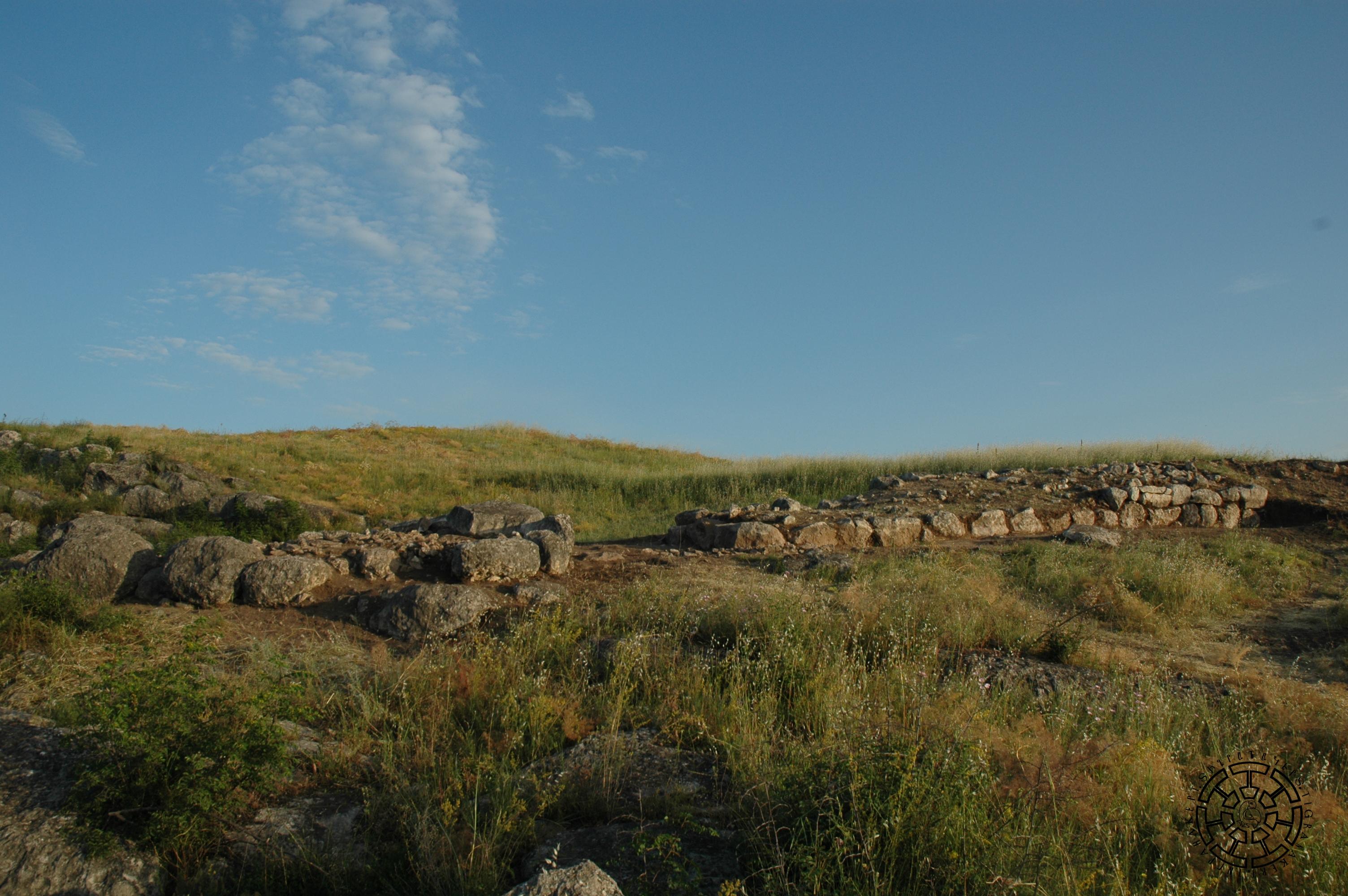
Fig. 3 A part of the fortress defensive wall and the entrance.
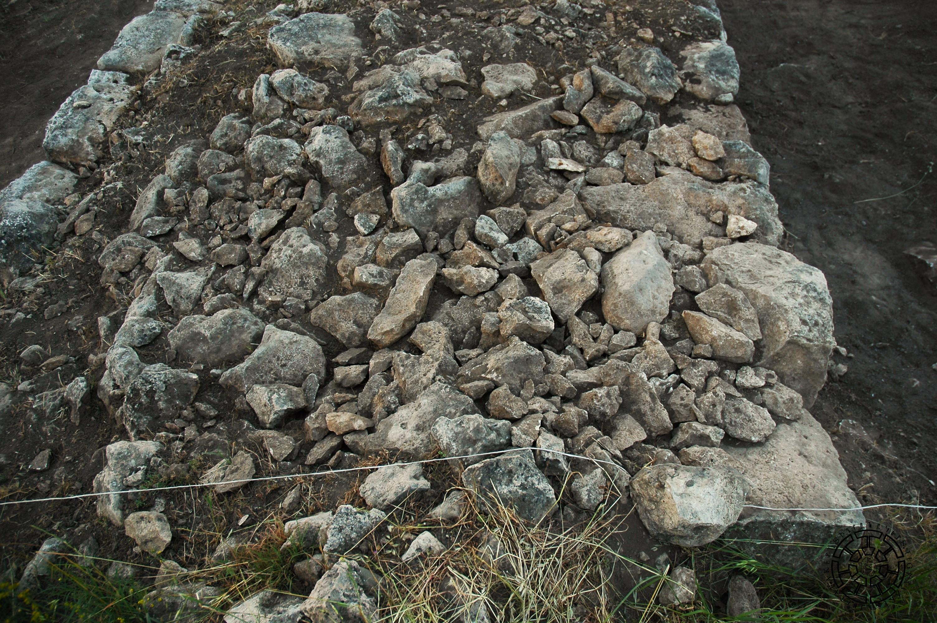
Fig. 4 The core of the defensive wall.
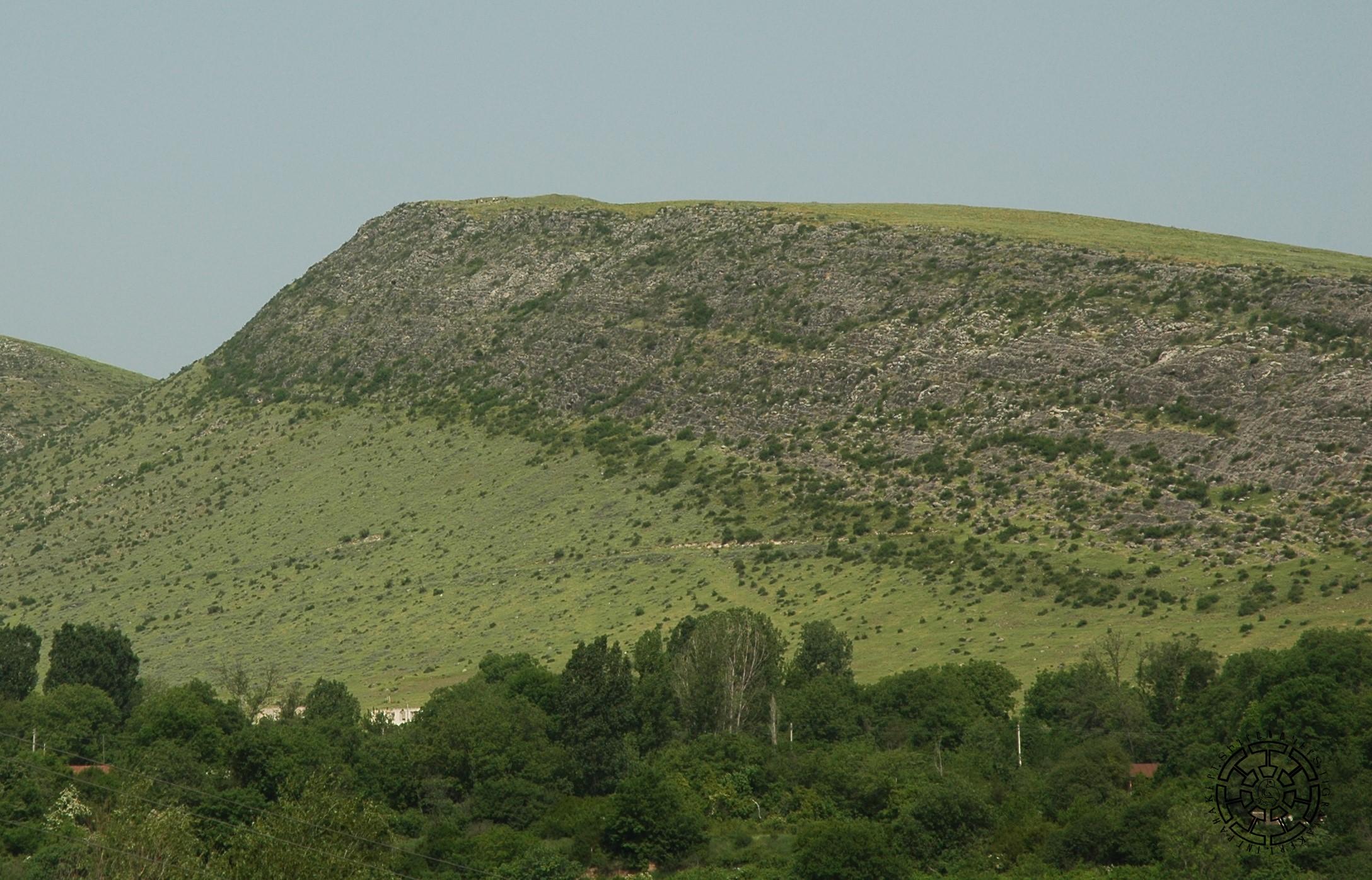
The fortress is situated on a hill facing Mount Vankasar, immediately following it. This powerful fortress, located on the mountain on the left bank of the Khachenaget River (Fig. 5), underscores the strategic importance given to the inner section of the second powerful river valley of Artsakh as a gate and defense system of the Highlands since ancient times. When considering the presence of Tigranakert nearby, the significance of this strategic location becomes even more apparent.
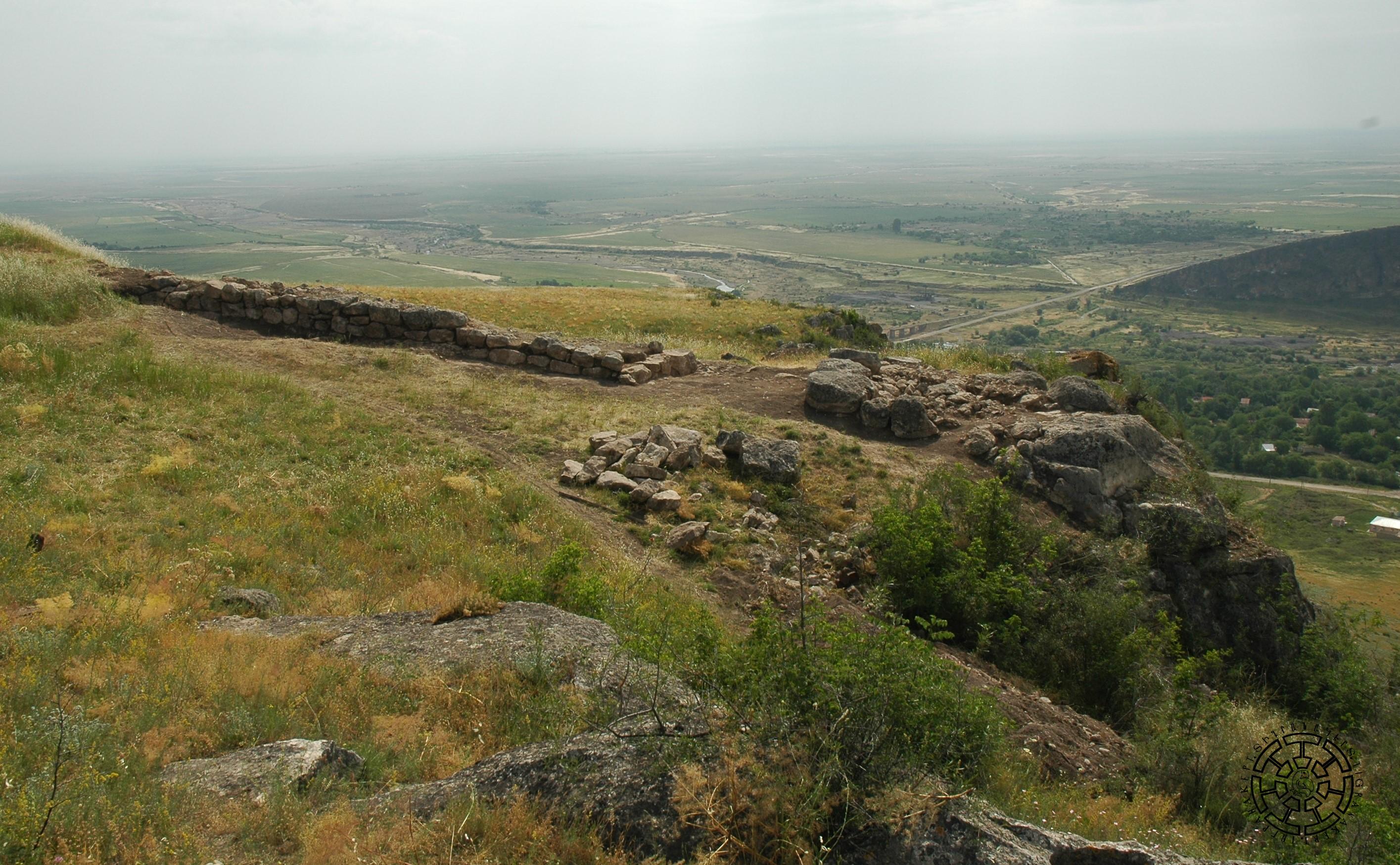
Fig. 5 The commanding position of the fortress over the Khachenaget River valley.